
Weather | Boise, ID | KTVB.com
Right Now
52
Fair
Feels like: 49°
Humidity: 48%
none: 0%
Wind: 7 mph ESE
KTVB Forecast

Weather News
- Midwest tornadoes flatten homes in Nebraska suburbs and leave trails of damage in Iowa
- New color-coded heat risk tool adds a level higher than red
- Lyrid meteor shower: When is the peak, where to look in the sky
- A storm dumps record rain across the desert nation of UAE and floods the Dubai airport
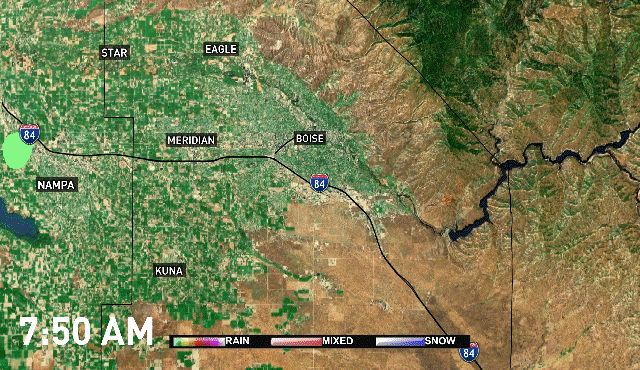
- NWS issues flood warning for Owyhee River
10-Day Forecast
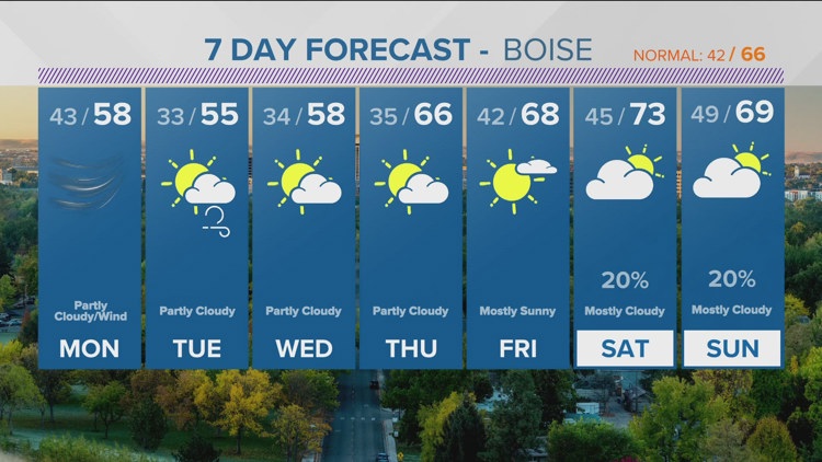
Mon
Apr 29
58
33
7%
22
MPH
WNW
Windy with a mix of sun and clouds. Highs in the upper 50s and lows in the low 30s.
45%
High
6:38 AM
8:45 PM
Tue
Apr 30
56
35
3%
15
MPH
WSW
Times of sun and clouds. Highs in the mid 50s and lows in the mid 30s.
37%
High
6:37 AM
8:46 PM
Wed
May 01
57
35
4%
14
MPH
NW
Mix of sun and clouds. Highs in the upper 50s and lows in the mid 30s.
43%
High
6:36 AM
8:47 PM
Thu
May 02
65
42
3%
12
MPH
S
Partly cloudy. Highs in the mid 60s and lows in the low 40s.
34%
High
6:34 AM
8:48 PM
Fri
May 03
68
45
2%
9
MPH
WNW
Times of sun and clouds. Highs in the upper 60s and lows in the mid 40s.
38%
High
6:33 AM
8:50 PM
Sat
May 04
75
49
24%
11
MPH
SE
Mostly cloudy. Highs in the mid 70s and lows in the upper 40s.
33%
Moderate
6:31 AM
8:51 PM
Sun
May 05
67
45
16%
11
MPH
WSW
Considerable cloudiness. Highs in the upper 60s and lows in the mid 40s.
44%
High
6:30 AM
8:52 PM
Mon
May 06
68
46
16%
10
MPH
WSW
Times of sun and clouds. Highs in the upper 60s and lows in the mid 40s.
44%
High
6:29 AM
8:53 PM
Tue
May 07
69
45
12%
11
MPH
W
Considerable cloudiness. Highs in the upper 60s and lows in the mid 40s.
42%
High
6:28 AM
8:54 PM
Hourly Forecast
11 PM
Sun
52°
0%
7
MPH
ESE
12 AM
Mon
52°
0%
7
MPH
E
1 AM
Mon
51°
0%
7
MPH
ESE
2 AM
Mon
50°
0%
5
MPH
S
3 AM
Mon
49°
1%
5
MPH
WSW
4 AM
Mon
47°
1%
4
MPH
W
5 AM
Mon
46°
1%
4
MPH
WNW
6 AM
Mon
45°
2%
3
MPH
NW
7 AM
Mon
45°
2%
4
MPH
WNW
8 AM
Mon
47°
1%
6
MPH
NW
9 AM
Mon
49°
0%
9
MPH
NW
10 AM
Mon
50°
0%
11
MPH
WNW